As we all know that Geography is a science related to the study of the lands, features, inhabitants, and phenomena of the Earth and other planets.
The term geography was first used by a person named Eratosthenes in 276–194 BC.
The knowledge of Geography helps us understand Earth and its human and natural complexities—not merely where objects are, but also how they have change over time.
Here is a word list of Geography-related terms for improving your vocabulary. Get to know about these words to help you explore the geographical features of the earth.
This list provides an access to easy geography terms for your elementary students to start their journey around the globe.
Geography Vocabulary Words – A to Z
Let’s explore the words related to geography and understand these terms with their meanings:
- Atlas: A collection of maps of the planet Earth.
- Atoll: A coral reef or an island in the shape of a ring.
- Altitude: Altitude is the measure of elevation above sea level.
- Arctic: the regions north of the Arctic Circle centered on the North Pole
- Arctic Circle: a line of latitude near but south of the north pole; it marks the northernmost point at which the sun is visible on the northern winter solstice and the southernmost point at which the midnight sun can be seen on the northern summer solstice
- Area: the extent of a 2-dimensional surface enclosed within a boundary
- Asia: the nations of the Asian continent collectively
- Border: An artificial line drawn segregating two geographical areas.
- Cartography: the making of maps and charts
- Chart: a map designed to assist navigation by air or sea
- City: a large and densely populated urban area;
- Compass rose: The modern compass rose has eight principal winds.
- Contour line: a line drawn on a map connecting points of equal height
- Capital: A city exercising primary status and where the government is located.
- Country: A political state or a nation. For example, India, Thailand.
- Continent: A large piece of land which is undivided and surrounded by water or is connected to other continents by land bridges.
- Desert: A large area covered with sand, where water or vegetation is either very little or not present at all.
- Earth: The 3rd planet of our solar system and the planet in which we all live.
- Equator: A line drawn on the center of the earth separating the north and south pole.
- Global: involving the entire earth; not limited or provincial in scope
- Globe: a sphere on which a map is represented
- GPS: a navigational system involving satellites and computers that can determine the latitude and longitude of a receiver on Earth
- Great circle: a circular line on the surface of a sphere formed by intersecting it with a plane passing through the center
- Geography: The study of the planet Earth’s physical features.
- Glacier: A mass of ice that is slowly moving.
- Hemisphere: half of the terrestrial globe
- Hemisphere: The half of a sphere. For example, Northern and Southern Hemisphere.
- International Date Line: The International Date Line is an internationally accepted demarcation on the surface of Earth, running between the South Pole and North Pole and serving as the boundary between one calendar day and the next
- Island: a land mass surrounded by water
- Key: something crucial for explaining
- Landform: A cirque may also be a similarly shaped landform arising from fluvial erosion
- Legend: brief description accompanying an illustration
- Latitude: The measure of the distance from the north or the south of the Equator.
- Longitude: The measure of the distance from the east or the west of Prime Meridian.
- Meridian: An imaginary circle passing through two poles.
- Mountain: A naturally elevated path of the Earth’s surface, that looks like a steep hill.
- Mercator Projection: a map projection of the earth onto a cylinder; areas appear greater the farther they are from the equator
- Miles: just a few miles away on the island
- Mountain range: a series of hills or mountains
- North Magnetic Pole: a point on the surface of Earth’s Northern Hemisphere at which the planet’s magnetic field points vertically downward
- North Pole: the northernmost point of the Earth’s axis
- Northeast: the compass point midway between north and east; at 45 degrees
- Northern Hemisphere: the hemisphere north of the equator
- Northwest: He described it native of the North West
- Plain: A piece of land that is flat.
- Plateau: A piece of land on high ground.
- Parallel: an imaginary line around the Earth parallel to the equator
- Peak: the top point of a mountain or hill
- Pole: one of two points of intersection of the Earth’s axis and the celestial sphere
- Relief map: a map having contour lines through points of equal elevation
- River: a large natural stream of water
- Road atlas: collection of road maps covering a region as small as a city or as large as a continent, typically bound together in a book
- Strait: A narrow passage of water connecting two water bodies.
- Sea level: level of the ocean’s surface used as a standard in reckoning land elevation or sea depth
- South: any region lying in or toward the south
- South America: the nations of the South American continent collectively
- South Magnetic Pole: the point on Earth’s Southern Hemisphere where the geomagnetic field lines are directed vertically upwards
- South Pole: the southernmost point of the Earth’s axis
- Southeast: the compass point midway between south and east; at 135 degrees
- Topography: The positioning of the unrefined and artificial features of the world.
- Tributary: A stream that flows into a large lake, or a river.
- Valley: An area of land that is low and between hills and mountains, mainly with a river that flows through it.
- Western Hemisphere: The Western Hemisphere is the half of Earth which lies west of the prime meridian and east of the anti-meridian.
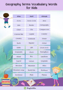
To test your knowledge, carefully look at the words given in the following picture and circle them if you have understood them.
Practice Geography Worksheets to learn more about the terms and what they mean.
Keep exploring EnglishBix to learn words related to different subjects like Maths, Science etc.
Quick Links